Interested in whitewater rafting for the first time and not quite sure where to start? We got you! Tributary Whitewater runs rafting trips on a variety of rivers in California, Oregon and Idaho. Trips range from mellow Class II to challenging Class V waters. Ages start at just 4+ and trip length ranges from from 1/2 day to multi-day raft and camp adventures.
We want to pair you up with the rafting trip that best suites you and your group – check out our recommendation on how to pick the best adventure for your group!
We recommend you start your search by looking at the age of your group. Determine who is the youngest or most timid rafter in your party and use our Trip Finder to narrow your search by age. Many of our rafting trips are age restricted and searching for a trip based on age is an easy way to begin.
The international scale of river difficulty defines river rapids on a consistent measurable scale from Class I (easiest) to Class VI (un-navigable).
We look at it in terms of peppers aka “spice”. The more peppers the spicier it gets!
In general ages 4+ (and non-swimmers) can join us on our Class II trips and ages 7+ (and non-swimmers) can join us on our Class III trips. Check out the detailed guidelines for each of the categories below.
The American River, near Sacramento offers the widest range of trips from Class II to Class IV offering something for everyone, starting at ages 4+.
We offer half-day, one-day and multi-day whitewater rafting adventures. After you have selected your age and trip difficulty narrow your search further by choosing the length that best fits your schedule.
Psst… did you know that our American River outpost is only 30min from Sacramento and 2hrs from the Bay Area making it an easy day trip? Plus we have our own private campground right on the river complete with glamping tents available for rent.
Heading on a vacation to California, Lake Tahoe or searching for bucket list style adventures? You came to the right spot!
Choosing Your River Rafting Trip by Location
Many of our trips are located close to popular tourist destinations like Lake Tahoe, Sacramento, San Francisco and Gold Country, making a rafting trip the perfect addition to your vacation.
Pick a Trip Perfect for Your Large Group
We make group coordination easy! Use our Trip Finder to narrow your search by group specific river rafting trips. And if you don’t see something that quite fits, reach out. We can work with you to make your group trip work!
Class I – Easy: Waves are small, regular; riffles.
Class II – Medium: Rapids of medium difficulty; swift current, passages are wide and clear.
Class III – Difficult: Waves numerous, high, irregular; rocks, eddies, rapids with passages that are clear though narrow, requiring expertise in maneuvering.
Class IV – Very Difficult Long rapids, waves powerful and irregular; dangerous rocks, boiling eddies; powerful and precise maneuvering required.
Class V – Extremely Difficult: Long and violent rapids following each other almost without interruption; riverbed extremely obstructed; big drops, violent current, very steep gradient.
Class VI – Un-navigable: The upper extreme of whitewater rivers, commercially un-runnable.
Class I and Class II river rafting trips are the easiest adventures we offer and are suitable for younger kids, (ages 4+), non-swimmers, timid children and seniors. Rapids are wide and clear offering splashy fun!
We can add inflatable kayaks to satisfy more adventurous participants, so they can be suitable for diverse groups. In addition, our American River rafting trips offer a wide range of difficulty and your group can head out on different trips during the day and regroup at our private campsite at night.
Multi-Day Rafting Trip on the Lower Klamath River
1/2 Day Lower Middle Fork of the American River
1/2 Day South Fork of the American River Discovery Run
Pro Tip: Check out our Family Rafting Specials where kids raft for 50% off mid-week on the South Fork of the American River.
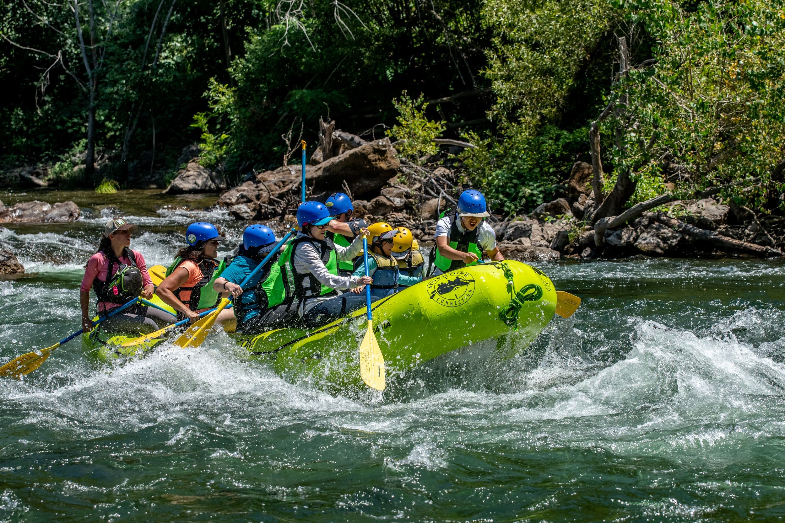
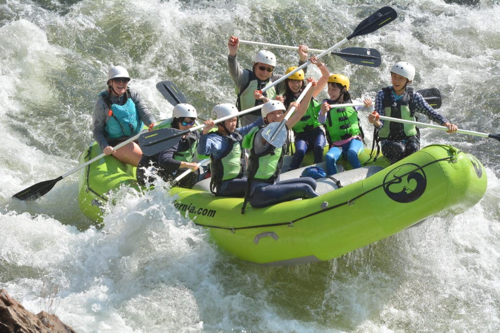
Class III rafting trips are ideal for most rafters, first timers, and even non-swimmers. When you think of white water rafting this is what you are picturing! These river rafting trips usually provide a great combination of action and calm waters, are fun, exciting and you will definitely get wet!
The American River near Sacramento offers a variety of Class III rafting trips ranging from half-day, to multi-day adventures.
Class III rafting trips are suitable for nearly everybody, including beginners, corporate groups, families (kids from 7+ years and up on most trips), youth groups, bachelor & bachelorette parties. This level is also exciting enough to bring some people back year after year!
1/2 Day Gorge Run South Fork American River
1/2 Day Chili Bar Run South Fork American River
Multi-Day South Fork American River Trips
Truckee River Rafting Near Lake Tahoe
Snake River / Hells Canyon Multi Day Trip
Rogue River Multi Day Trip
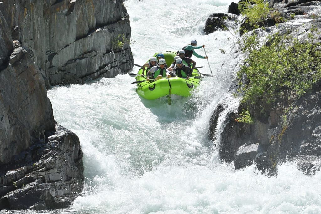
Class IV river rafting trips are great for those with previous Class III experience looking for a bit more excitement. Minimum age is 14 years old and swimming abilities are required.
The American River offers some of the best Class IV rafting waters, with one of the most notable on the Middle Fork’s Tunnel Chute.
Swimming skills are required to participate in Class IV trips. Your Personal Flotation Device (PFD aka: Life Jacket) will assist help you stay afloat, but it will not necessarily save your life. So this level of rafting requires that you can take some personal action if you fall in the river. For example, you may have to swim in faster moving water to avoid some danger. You will be pulled back into the raft very quickly in most situations, but that is not always the case. Your mental attitude can be as important as your swimming skills. If you think you might panic if you fall in, then consider an easier trip.
1 Day North Fork American River
1 Day Middle Fork American River
1 Day North Yuba River
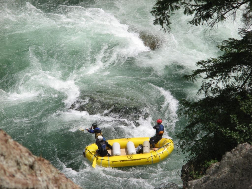
Advanced rafting trips in California offer the most difficult runs featuring many Class V rapids. Water hydraulics are very strong, with large drops and rock gardens. All participants must have previous Class IV experience. We also require all participants to have excellent swimming skills. A Class V swim test may be administered prior to launching which would include being able to swim in a strong current, under the raft, and getting back in a raft unassisted.
Absolutely NO NON-SWIMMERS on these advanced rafting trips! Minimum age usually 16 years, but that will depend on water levels and experience.
Yup, this is super spice!
We launch trips on many different rivers in California, Oregon and Idaho. For questions give our main office a call – we would love to talk with you about our trips and rivers.
Subscribe to our newsletter to all the latest news from the river, info about our specials and more!
Our vision is to create a sustainable and equitable reality where our rivers are enjoyed and protected, a place where families and friends can be inspired and challenged.
Tributary Whitewater Tours has been running rivers since we were first founded in 1978. Since we opened 40+ years ago we have expanded to include Adventure Connection, Mariah Wilderness Expeditions, High Desert River Outfitters, Canyon Outfitters and are the parent company of Raft California and Raft Oregon. While some things have changed over the years, Tributary remains a family-run small business with the same passion for the river and the mission of leading others to experience it.
© 2024, Tributary Whitewater LLC, All Rights Reserved