The North Yuba River travels through the scenic Tahoe National Forest, and is fed by the snow-melt from the majestic 8000+ peaks of the Sierra Buttes. It is located at the north end of the fabled Mother Lode highway (Hwy 49). The nearby mining towns of Downieville and Sierra City provide rustic charm and great history. Enjoy a variety of camping options on the river and near the buttes, a selection of local restaurants, and historic landmarks.
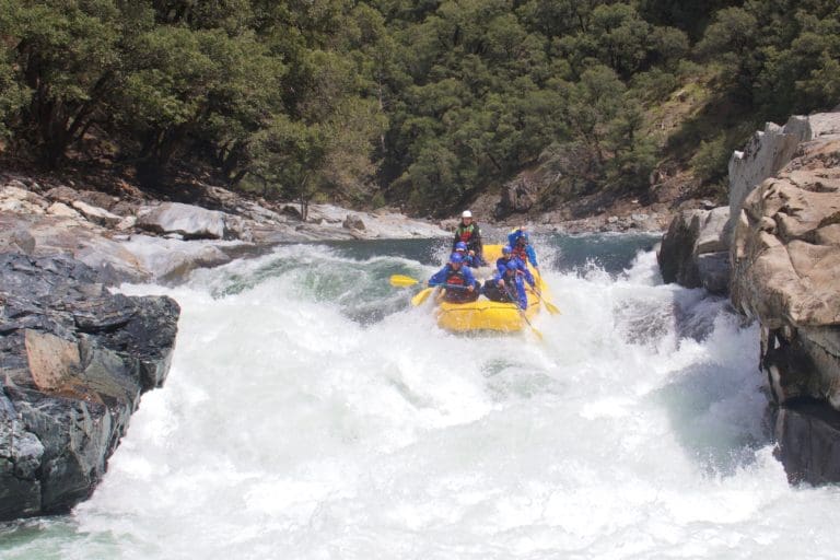
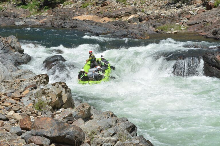
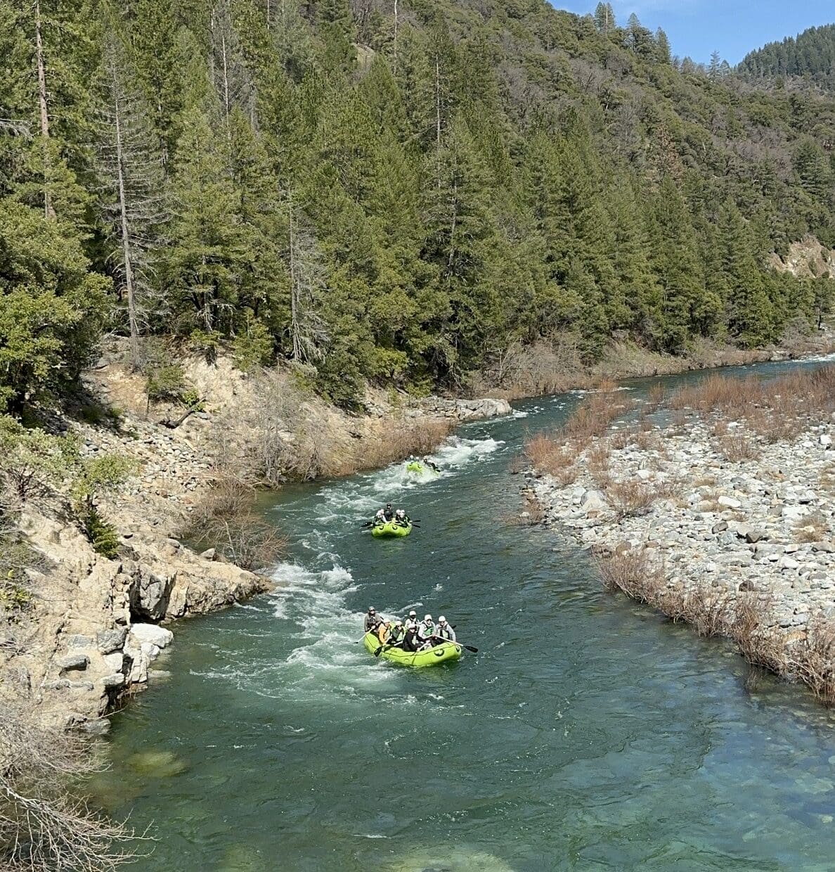
Outdoor enthusiasts are drawn to the North Yuba River for its whitewater rafting opportunities, ranging from exhilarating Class II to Class IV rapids. The stretch between Downieville and Goodyears Bar is particularly popular, offering an adrenaline-pumping white water rafting amid breathtaking natural scenery. Beyond rafting, the region beckons hikers with picturesque trails that unveil panoramic views of the river and its canyon, providing a tranquil escape into the heart of the Sierra Nevada foothills.
Great opportunities are available in the area for hiking, fishing and mountain biking (including the famous Downieville Downhill). For those travelling from the Bay Area or Sacramento, the towns of Grass Valley and Nevada City are conveniently on your way. They provide unique experiences and accommodations to extend your stay.
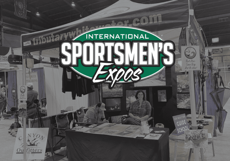
Tributary Whitewater Tours operates under permit from the Tahoe National Forest Yuba River Ranger District and is an equal opportunity service provider.
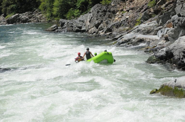
Rafting trips on the North Yuba River are sought after by paddlers of all experience levels. The runs range from Class 4-5+, and we sometimes combine more than one run into a day trip. White water rafting tours on the North Yuba River offer unique, uncrowded, and secluded experience. We are one of the original permit holders for the North Yuba are there are still only 3 permitted outfitters.
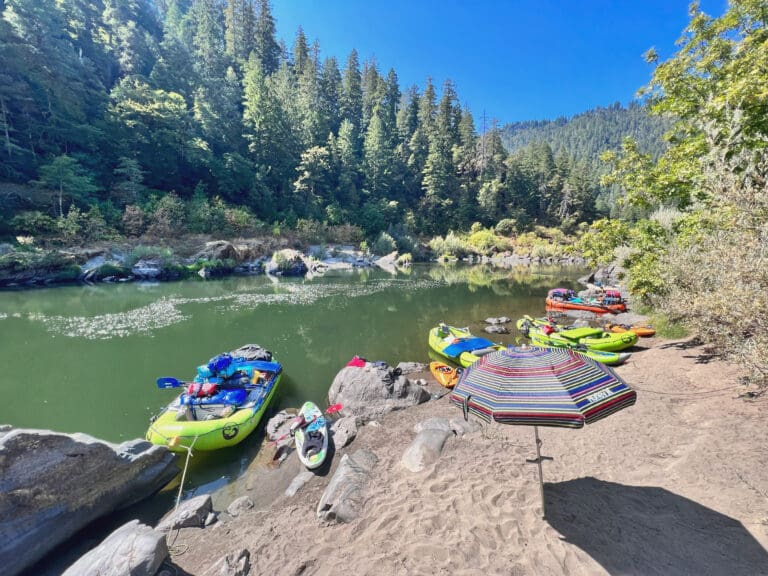
The North Yuba River offers both veterans and active first-timers a variety of whitewater rafting thrills on over 28 miles of river. Raft trips range from one day to multi-day adventures and can be combined for varying levels of difficulty. At higher flows previous paddling experience is recommended. However people who are competent swimmers, athletic and adventurous can enjoy some of these runs when the peak snow melt is over. Even at lower flows, the North Yuba River offers exciting rafting in smaller boats.
Searching for a rafting trip a bit closer to Lake Tahoe? Try Truckee rafting. Truckee River rafting trips are only 20 min from North Lake and feature Class III rapids and half day adventures.
The North Yuba River carries a rich history shaped by the state’s mining era. During the mid-19th century Gold Rush, the North Yuba drew in prospectors seeking fortune in its waters. The riverbanks housed many mining camps and saw the construction of hydraulic mining systems.. Today, remnants of this historical period, such as abandoned mining equipment and ghost towns, stand along the North Yuba River during the Gold Rush.
The charming mountain town of Downieville, located on the Yuba River where we run rafting trips, was once a thriving Gold Rush town and came close to becoming the state capital in the mid-19th century. Its booming economy and strategic location made it a strong contender. However, Sacramento, with its central location and navigable waterways, was ultimately chosen.
In addition to it’s bid for being the capital Downieville has another claim to fame, the Downieville mountain bike trail. The Downieville Downhill is a renowned mountain biking event that attracts riders from all over for one of the most challenging races in the United States. The course itself descends over 4,000 feet from Packer Saddle to the historic town below. This event, part of the larger Downieville Classic, has cemented Downieville’s status as a premier destination for mountain bikers.
The North Yuba River features a fantastic population of native fish species, including rainbow and brown trout, making it a popular destination for anglers. The surrounding riparian zones provide vital habitat for various bird species, contributing to the area’s wildlife. Additionally, the river is home to other animals such as deer, black bears, and smaller mammals. Conservation efforts along the North Yuba focus on preserving the natural beauty of the river and its surroundings, ensuring that future generations can continue to enjoy the historical, recreational, and ecological treasures it offers.
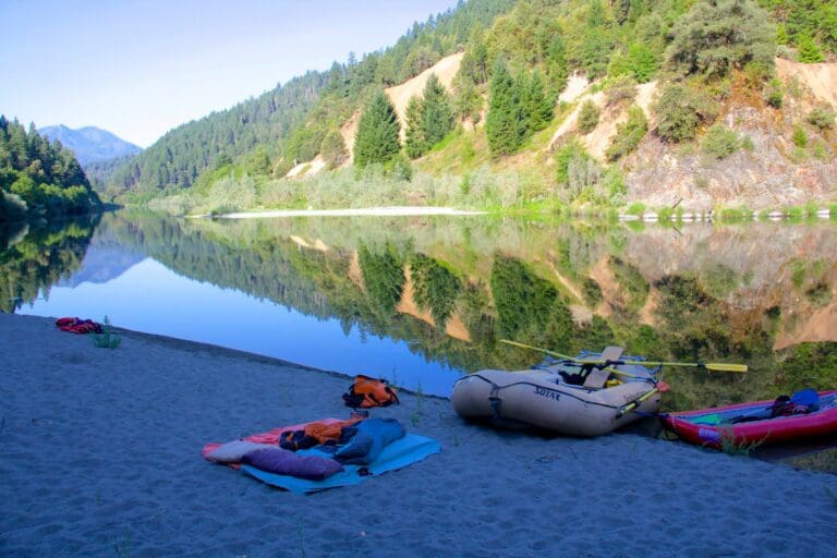
Camping:
The North Yuba River features a range of whitewater rapids, typically ranging from Class II to Class IV, offering an exciting yet accessible experience for both novice and experienced rafters.
The North Yuba River is located in the Sierra Nevada Mountains in the Sierra Buttes area near Downieville, California.
The North Yuba River is specifically located in the northern part of California’s Sierra Nevada region, flowing through Sierra and Plumas Counties.
Visitors can enjoy thrilling whitewater rafting adventures, with the stretch between Downieville and Goodyears Bar offering Class II to Class IV rapids for varying levels of excitement. Additionally, fishing enthusiasts can explore excellent fishing spots along the riverbanks. Hikers can also enjoy the scenic trails that unveil panoramic views of the river and its surroundings.The river provides an exhilarating yet manageable experience for rafters and kayakers, making it an attractive destination for those seeking a balance of excitement and enjoyment in a scenic environment.
The duration to float the North Yuba River depends on the selected section and water conditions, but a typical rafting trip on popular stretches such as Downieville to Goodyears Bar can take approximately 3 to 5 hours.
For fishing on the North Yuba River, consider targeting areas near Downieville, Sierra City, and downstream from the Highway 49 bridge, as these locations are known for providing excellent fishing opportunities, particularly for rainbow and brown trout. The diverse habitats along these stretches offer varied conditions for anglers, from riffles and pools to deeper runs, enhancing the overall fishing experience on the North Yuba River.
The North Yuba River played a significant role during the California Gold Rush during the mid 19th century.
The river currently has headwaters over 7,000 feet yet it experiences significant elevation changes as it courses through the Sierra Nevada, creating a dynamic and diverse landscape.
It is famous for its significant historical role during the California Gold Rush in the mid-19th century. The town of Downieville, situated along the river, became a bustling center for gold prospectors seeking their fortunes, and remnants of this era, including mining sites.
As we journey down the North Yuba River, we’ll pass through lands that were historically inhabited by various Native American communities, including the Nisenan and Maidu tribes.
Acknowledging the Indigenous communities whose lands we visit is a crucial step in understanding our shared history and the ongoing challenges faced by these populations today. For more insight, visit our Territory Acknowledgement page. We encourage you to learn about the people whose land we’re privileged to explore by following the links above.
Our Territory Acknowledgement is an evolving project. If you find missing information or acknowledgments, please share it with us. Together, we can ensure accuracy, inclusivity, and respect. Thank you.
We launch trips on many different rivers in California, Oregon and Idaho. For questions give our main office a call – we would love to talk with you about our trips and rivers.
Subscribe to our newsletter to all the latest news from the river, info about our specials and more!
Our vision is to create a sustainable and equitable reality where our rivers are enjoyed and protected, a place where families and friends can be inspired and challenged.
Tributary Whitewater Tours has been running rivers since we were first founded in 1978. Since we opened 40+ years ago we have expanded to include Adventure Connection, Mariah Wilderness Expeditions, High Desert River Outfitters, Canyon Outfitters and are the parent company of Raft California and Raft Oregon. While some things have changed over the years, Tributary remains a family-run small business with the same passion for the river and the mission of leading others to experience it.
© 2024, Tributary Whitewater LLC, All Rights Reserved